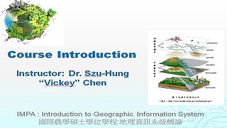
課程介紹
[Course Description]
This course will focus on introducing students how they can apply geographic information system technology to analyze target issues, such as problems related to natural resource management.
Topics covered include introduction to operate GIS software (e.g., QGIS & ArcGIS), identifying and understanding sources of spatial information and datasets, how to include GIS application into problem solving, its spatial analysis capabilities, and also other toolkits such as Google Earth, MS Excel(data preparation and processing), MS Access (data management) , which may be introduced and used to aim the analysis.
[Course Objectives]
For general outcomes, students are expected to learn:
- Identify data needs relating to target issues and appropriate processes in the context of a GIS project.
- Formulate or assess a framework in spatial perspectives; then understand their applicability for problem solving.
- Design maps as a form of visual communication according to cartographic principles.
- Develop a reasonable executing plan and timelines that can lead to a desired project outcome.
- Display recognition of the responsibility of adhering to ethical standards in decision‐making on behalf of clients and the public.
- Interpret the analyzing findings and deliver a technical report that outlines problems and suggests potential solutions.
For specific outcomes, students are expected :
- to deliver and present a final project in a context of GIS and/or spatial analysis as professional practicum.
[Course Delivery]
- This is an online, distant-learning and face-to-face hybrid course. However, online delivery instruction will be weighed more.
- All class materials can be accessed through NCHU iLearning. NCHU iLearning may also be used to conduct parts of class assessments, to submit course assignments, to facilitate discussions, and to distribute announcements.
- NCHU iLearning can be accessed via NCHU iLearning Portal (https://lms.nchu.edu.tw/ ) or NCHU Single Sign On System.
- Teaching methods include:
- Previewing and reviewing course materials.
- Hand-on practicing on modules and completing relating assessments.
- Developing a final project in a context of GIS applications and/or spatial analysis.
- Bonus assignments or random quiz may be given when needed.
- Office hours are running by an open door, but appointment-preferred policy. Students are also encouraged to schedule appointments with the instructor.
教科書:
- Class handouts and a list of assigned readings provided by the instructor through NCHU iLearning.
- Other supporting reference: Theobald, D. M. (2013). GIS Concepts and ArcGIS Methods : Basics & Advanced (5th ed.). Fort Collins, CO., U.S.A.: Conservation Planning Technologies.
教學進度:
Please refer to the course syllabus.
本課程不開放報名

